Week 35: Inverness to Cuthill & the Dornoch Firth
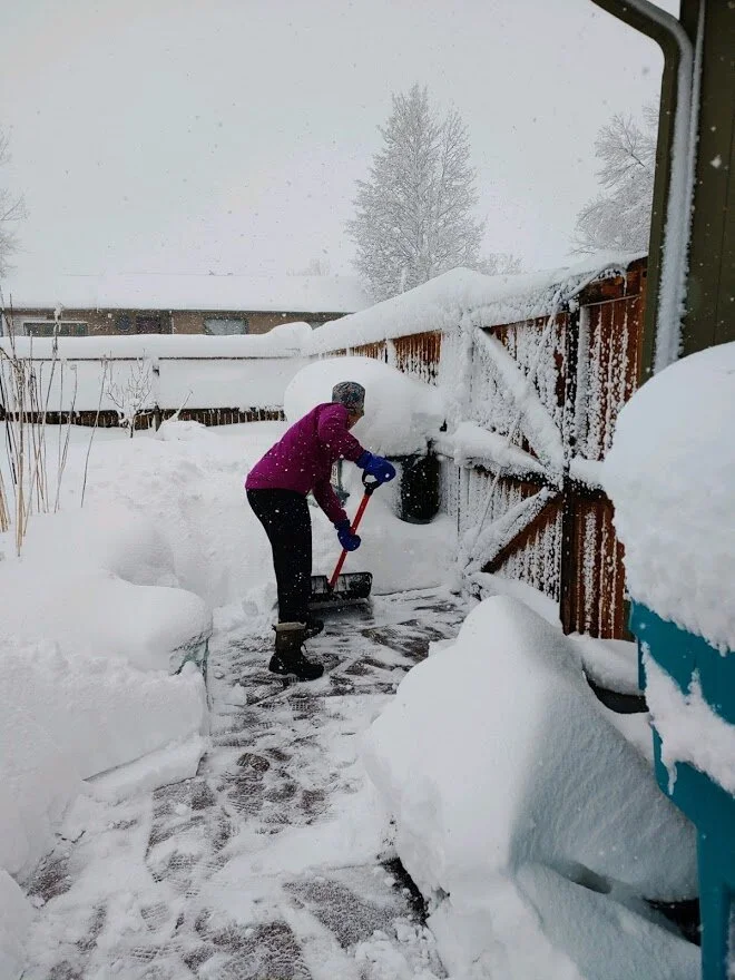
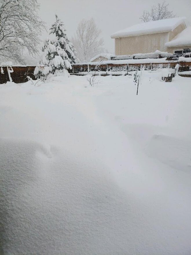
Happy spring, friends! Remember the big incoming storm I mentioned this time last week? Well, it showed up… and then some! We estimate 2.5 feet of snow at our house, and more up the hill from us in the foothills. It was TRULY amazing… and you’ll notice I haven’t logged many miles in the past week, as most of my exercise hasn’t been running or rowing: it’s been shoveling snow!
When we woke up Sunday morning to find well over a foot of snow already on the ground, the pups looked at us with incredulity, like, “Really, ladies? You expect us to go out and pee in that?!” But after we dug them some tunnels to ease their way, they adjusted, and since then they’ve gotten pretty intrepid, breaking trail all around the perimeter of the yard.
Saturday night, the snowfall accelerated… but as Gus demonstrates, it was only a couple inches deep when the pups had their final pee break before bed.
Newton, first pup outside on Sunday morning, speaks for all four by making it clear: there is NO way we’re going out in this unassisted!
With a bit of a path carved out, Carter agrees to at least give it a try. Behind him, our clothesline is sagging so much it almost looks like a hammock.
Jasper was not very excited about braving the wind and ongoing snowfall Sunday morning.
We had to keep re-shoveling paths throughout Sunday, as the snow continued to fall.
I shoveled a lot of snow on Sunday; it was still coming down, but had I waited ‘til Monday to shovel, the loads would’ve been truly overwhelming!
It took a little more digging on Monday morning to re-open the paths for the pups before we could get them outside.
By sunrise on Monday, the snow stopped falling, and the great dig-out began.
Oh…and guess what? More snow is expected tonight. Fun times!
Certified guide in Scotland, Kirsten Griew
And now… back to our virtual trek the length of Great Britain!
For the past few weeks, we have been lucky enough to have certified Blue Badge guide for Scotland Kirsten Griew sharing stories and history as we continue making our way north. Kirsten too is participating in our journey from Land’s End to John O’Groats, moving virtually over terrain she’s seen in real life.
What follows today comes from mainly from Kirsten, with just a few notes thrown in from me. Thanks, Kirsten… and enjoy, friends!
We ended last week in Inverness, the unofficial “capital of the Highlands.” From Inverness north to John O'Groats, we will be following the section of the north sea that is known as the Moray Firth. It is the triangle of sea that cuts into the northeast of Scotland, giving the northern most part of the country its distinctive shape. However, the road north also crosses over three more, smaller firths (estuaries) that flow out into the Moray Firth. Those are the three crossings we’ll make during this week’s post.
The bridges that cross these three smaller firths were only built over the last 40 years or so. Prior to this, the road would weave further upstream to cross each one, then back out towards the coast, adding on a great number of miles. So the final stretch of the Land’s End to John O’Groats challenge has definitely been made a little more direct since then!
Kessock Bridge over the Beauly Firth, at sunrise. (Photo by wikimedia user DJ MacPherson)
The first crossing, immediately leaving Inverness, is the Kessock Bridge over the Beauly Firth, which opened in 1982. It sits at the very top of the Great Glen that we were following on the road to Inverness. The Glen is the most seismically active area in Britain (which doesn't actually mean very much) but as the bridge sits nearly on the Great Glen Fault, it was specifically designed to withstand an earthquake - just in case.
The picturesque Black Isle fishing village of Avoch
Once we reach the other side of the bridge we are on a peninsula called the Black Isle. It is not an island, and it is very lush and green - so a strange name. There are theories that the name is from the fact that when it would snow, as the peninsula is surrounded on 3 sides by sea (in the form of the various firths) the snow would not lie as quickly as it would on the surrounding hilly areas, leaving it looking like a black island in contrast. Alternatively there is a thought that is could be connected with a local saint who was alive about 1000AD called St Duthac - his name is considered similar enough to the Scottish Gaelic word for black, 'dubh', that it could be the origin.
Probably the most well known person connected with the Black Isle is a 17th-century man, Kenneth MacKenzie - more commonly known as The Brahan Seer. Brahan is a village on the Black Isle, and he was a Seer, in that it was believed he had the gift of the Second Sight. As the story goes, when he was a young boy, his mother was walking through a graveyard during the night (as you do…go figure!) As sunrise approached, she saw the ghosts of those buried there all returning to their graves - all except one. The last raced back in just as daylight was approaching, but Kenneth's mother was curious, and blocked the ghost's way. If the ghost did not get back to its grave before sunrise there would be all sorts of problems for it.
Kenneth's mother demanded to know why the ghost was late - evidently she was the ghost of a Danish princess and had to get all the way there and back before dawn, which took quite some time. Then Kenneth's mother requested a special gift for her son, which was granted. She let the ghost pass, and the ghost got back into her grave as the first ray of sunshine appeared on the horizon. Later that day, young Kenneth was wandering through a near-by field, he spotted a stone with a hole through it and as he looked through the hole he was able to clearly see events that would happen in the future and also events that were taking place in his own time, but elsewhere in the world.
A monument to the Brahan Seer sits on the Ross-shire estate where he once lived.
The Brahan Seer is viewed as a type of Scottish Nostradamus, and made predictions that seem all too true. For example, he predicted the Battle of Culloden that took place the following century. The last battle on British soil, in which the Jacobites (who we heard about in a previous blog post) were finally and completely defeated in 1746. He talked about a battle in which the finest blood of the Highlands would be spilled, named the exact place, and said, (paraphrasing) 'I will not live to see it, and I am glad of that'.
He predicted the Clearances (after Culloden and the government 'subduing' of the Highlands, Highland landowners forced the people who had lived on the land for generations over centuries, in favour of more profitable sheep farming). He talked about the 'big sheep' coming to the Highlands in a negative manner.
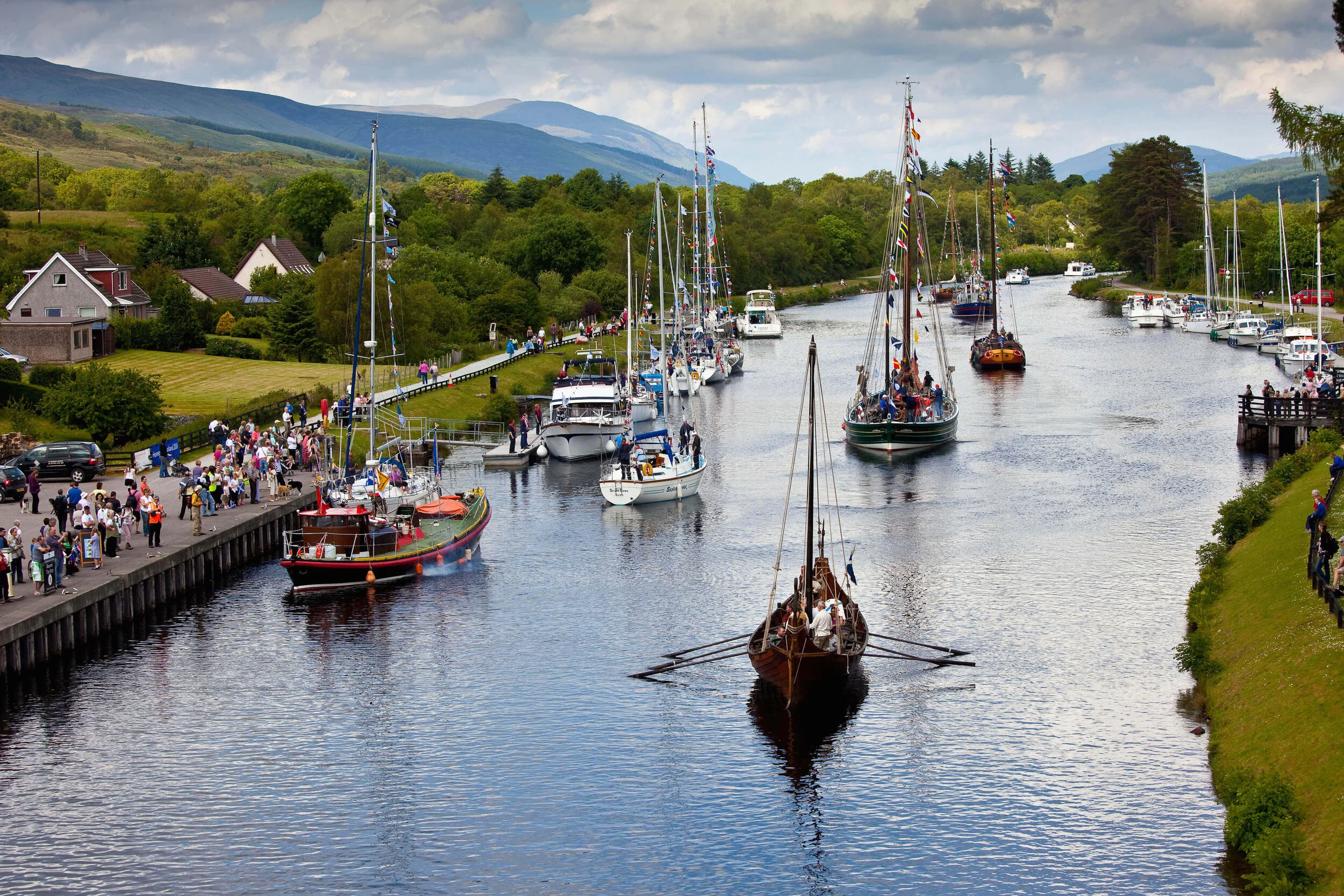
He predicted the Caledonian Canal that runs up the Great Glen ('full masted ships will sail behind Tomnahurich' - this is a hill in Inverness, so people must have wondered how ships would sail over dry land). He talked of carriages being pulled by horses belching fire and steam in lines across the Highlands (the railway...).
Masted ships in the Caledonian Canal.
Predictions that came true more recently include: 'A black rain will bring riches to Aberdeen' - in the 1970s Aberdeen became the oil capital of Europe.
And: 'Scotland will regain her parliament when it is possible to walk dry-shod between England and France' - the Channel Tunnel was completed in 1994, and Scotland voted to have her own parliament reformed in 1997, which met for the first time in nearly 300 years in 1999.
Scotland’s new parliament building, which opened in 2004.
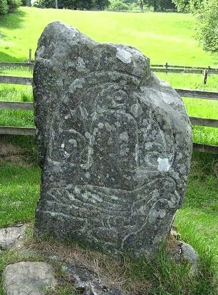
The Eagle Stone in Strathpeffer (photo by Wikimedia user ADSharpe)
There are also predictions yet to come true... for example, he mentions that when the Eagle Stone falls over for a third time, terrible things will happen in Strathpeffer. The stone is a landmark in this nearby town, carved by the people of the area 1500+ years ago (the Picts) with an image of an eagle. It has fallen twice in its history, and the local people have cemented it in place to stop it falling again!
He also mentioned that a ship going from mainland Scotland to the Isle of Lewis will sink and the only survivors will be those wearing red shoes - if you ever take the ferry that does that route, you will see a LOT of people in red shoes!
The standing stones on the Isle of Lewis seem worth risking the ferry for.
There is some wonderful wildlife in this area too. Red Kites, which became extinct in England in 1871 and in Scotland in 1879, were reintroduced nearby in 1989. Between 1989 and 1993, 93 birds were reintroduced to carefully chosen sites, and by 1992 the birds were breeding successfully in the wild.
Once considered vermin, with bounties on their heads, Red Kites are rebounding in Scotland today.
Also, as we cross over the next bridge — over the Cromarty Firth — there are regularly harbour seals lying about on the rocks to admire.
Cromarty Bridge, over the Cromarty Firth, opened in 1979.
Seals basking on rocks at low tide, Cromarty Firth, Ross-shire, Scotland. (Photo by David Paterson/Alamy)
The next peninsula is called Tarbat, a name that is common in the Scottish Highlands and also over in Ireland. It comes from a mix of Gaelic and Norse languages, and means 'to carry across,' as it was where Vikings would find a small stretch of land between two bodies of water, where they would pick up their boats and carry them.
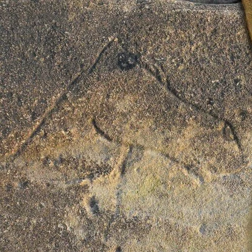
A beautiful Pictish horse, carved just above the tide line at a beach about 1/2 mile north of Portmahomack.
Tarbat has some particularly rich Pictish remains. The Picts are thought to be a little mysterious, as we don't have any conventional writing from them. However, we have lots and lots of amazing carved stones all over the very northern Highlands, as well as further south to the east side of the country. As well as images of animals, people and battles, the stones have many recurring symbols, which clearly was a language, but one we haven't fully deciphered.
One of the most famous stones, now in the National Museum of Scotland in Edinburgh, was originally on the Tarbat peninsula - called the Hilton of Cadboll stone. It has a hunting scene, with the main figure a woman riding side saddle. There are some classic Pictish symbols in the panel above her. At the nearby village of Portmahomack, they (fairly) recently found the remains of the first ever discovered Pictish monastery. The Picts were Christianised by the likes of St Columba and the symbols on their stones reflect that, with more crosses and less non-Christian imagery over time.
This is a replica of the original pictish slab; the original is in the National Museum of Scotland in Edinburgh. The replica was carved by Barry Grove and completed in the year 2000. It stands close to the site of the original stone, and in this image, the lumpy ground just beyond the fence is the remains of an ancient chapel. (Photo: Richard Dorrell)
Just before we cross the next bridge we pass another famous distillery - Glenmorangie. Theirs is the most popular Scotch whisky within Scotland. The image on its label comes straight from the Hilton of Cadboll Stone.
Glenmorangie whisky label (left) and the Hilton of Cadboll stone (right)
Crossing the final bridge, over the Dornoch Firth, affords some spectacular views. On the far side of the firth is the town of Dornoch, home to the most northerly championship golf course in the world. Evidently, monks from St Andrews were transferred to the Cathedral here and brought the game they were playing on the sandy links there, to their new home.
The Dornoch Firth Bridge opened in 1991.
There is still a cathedral building in Dornoch, although not much is original. It was almost entirely destroyed at the Protestant Reformation in 1560 and most of it is now from the 2 restorations in 1616 and the 1830s. In 2000, it gained some worldwide recognition, when Madonna and her then husband Guy Ritchie chose it as the place to have their son Rocco christened!
Another nearby place that Madonna graced with her presence is Skibo Castle, where she and Guy Ritchie married. It is just a little upstream on the north of the Dornoch Firth. There was an early medieval Skibo Castle, but the one standing now dates to the eighteenth century and was greatly restored and enhanced in the nineteenth century by Andrew Carnegie. As we saw in a previous post, Carnegie came from Dunfermline, just north of Edinburgh. However, after making his name in the steel industry in Pennsylvania, he bought Skibo as a holiday home. Evidently he loved creating gadgets for the house. He had a model railway, with track from the kitchen to the dining room, so whenever they had dinner guests, the food would arrive on the top of the train carriages!
Another story the guides at the Castle tell is that Carnegie also invented a bath tub on wheels, which was activated by a remote control. Whatever room he was in (presumably on just one floor) if he pressed the button on the control, the bath would trundle into that room. Apparently, one day, shortly after creating this, he had some guests to whom he was keen to show off his new invention. Excitedly he pressed the button, it worked perfectly, the bath came slowly wheeling into the room full of his friends.... the only problem was that he hadn't realised that his wife was, in fact, in it at the time!
A glimpse of the lavish interiors of Skibo.
I couldn’t find an image of a wheeled bathtub - just this photo of one of Skibo’s bathrooms. But imagine: if these were wheeled, their occupants could race each other!
Next week, we’ll explore the final stretch of this very long journey along the length of Great Britain. Thank you, friends, for joining me on this long virtual trip; our journey is nearing its end!
Fancy a pint?
Unlike the Naylor brothers, who pledged to “abstain from all intoxicating drink” during their 1871 walk on this route, I’m not at all opposed to popping into interesting-looking pubs along the way. Here are a few along this stretch of the journey… this time, curated by Kirsten Griew, who has actually been there in person!
The patio (and very full bike rack) of the Cromarty Arms.
The Cromarty Arms is a family-run pub providing bed and breakfast accommodation and delicious home-made bar meals. It also promotes itself as a convenient stopping point for cyclists going either north or south.
In addition to offering local brews (including those of the Cromarty Brewing Company) the pub hosts a traditional music session on the 2nd Friday of every month.
In Tain, a unique pub, Platform 1864, serves ale and cider from a building that once was a train station.
The Tain station opened in 1864, but passenger numbers fell after the 1960s, resulting in the closure of the station. But in 2015, locally trained Chef Graham Rooney converted the historic building into a pub.
A local school were invited to hold a competition, and the name "Platform 1864" was chosen. The pub bills itself as family and dog friendly, with music on Saturday evenings.
Inside Platform 1864
The Coach House, in Dornoch
The Coach House in Dornoch, until recently known as the Old Dornoch Inn, is recently restored, with respect given to its history as Dornoch’s old coaching inn.
The Mackay family takes pride in sourcing as many of the pub’s ingredients as possible locally, and the situation is both historic and convenient, overlooking Dornoch Square.
Sustenance for the Hungry Vegan
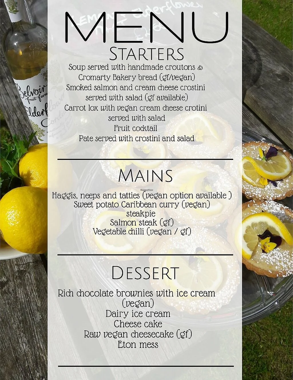
A menu offered by the Fortrose Cafe. Mmmm!
The Fortrose Café has offered an entirely vegan menu since 2019, baked goods too! And the photos of their dishes are mouthwateringly appealing!
One additional reason to support the Fortrose: its social media demonstrates it is a caring community hub, with recent posts promoting the pet-food pantry for people who have fallen on hard times, so they can continue to keep (and feed) their furry family members.
Inside the Storehouse Restaurant
In Foulis Ferry, the Storehouse Restaurant offers vegetarian dishes, and promises its chefs are happy to adjust them into vegan dishes for any guests requesting them.
The restaurant is situated on the Cromarty Firth, with water views.
In Dornoch, Cocoa Mountain is the perfect place to purchase locally-made chocolate (including vegan varieties!) But it also has a vegan-friendly café, with options made from locally-sourced vegetables, and vegan hot chocolate you can request made with soy or oat milk.
Vegan hot cocoa and truffles at Cocoa Mountain, Dornoch
